–> itinerancesaintdenis-avranches.org/ <–
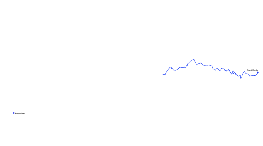
This page tells the making of the artistic project “Itinerances”, made with Felix Goulard in 2023. Felix is walking between Saint-Denis and Avranches, without any map nor GPS, and the audience has the ability to follow his path live, drawn as a pure stroke. This page is just a notebook on how we made the page, as a way to remember and it might provide useful later.
The hardware
To track him we needed a tracking device, that works in lost areas and has sufficient battery for a few days. We decided to go for the TkStar 905 because it was cheap and doesn’t need any subscription, just a sim card. However, as a notice we might have to change for further projects because it still uses the GSM standard, which should soon be shutdown in France.
Getting the data online
I discovered the existence of Traccar, an open source solution to track any GPS, with a useful and simple API.
Because the project hold only for a few weeks we decided not to bother to install it but to take the account for one month. In the traccar server it is pretty straightforward : you select to add a device, and follows the steps.
The only tricky thing is to find the url to configure the GPS, but basically it comes from this list https://www.traccar.org/devices/
(and the IP is is given when you open an account).
After that, you should see the GPS connected into your traccar account. Since we didn’t wanted to show the map but only the path, we only need a simple php script to retrieve the coordinates, and then to draw them in the website. So we opted to record the coordinates as a basic list (no formatting, just lines)
I won’t go into the details for the drawing part because it’s really basic – reading the file, converting the latitude-longitude to screen coordinates and drawing through a canvas -, you have the whole script on my gitlab: